

Nepal continues to struggle to come to terms with last week’s natural disaster that caused heavy loss of lives and infrastructure in one of its remotest regions abutting Tibet. The disaster has brought into sharp focus the need to review the ongoing mega projects in such fragile ecosystems. The most mysterious project humanity has executed on an unprecedented scale is the Chinese-sponsored hydropower project on the Brahmaputra River, known in China as the Yarlung Tsangpo. Experts have raised concerns about the safety of the entire surrounding Himalayan region.
Introduction
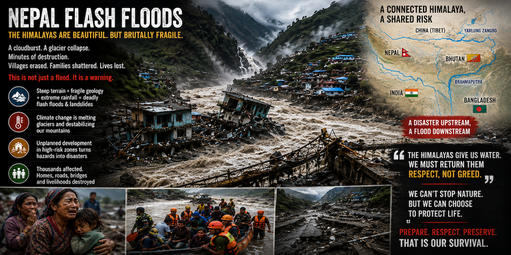
On August 26, 2026, the Nepal–Tibet floods brought devastating consequences that shocked the affected communities. Unlike typical monsoon rains, this disaster was triggered by a massive collapse of glaciers, ice, and rocks in the Langtang–Lhende Khola area near the Nepal–China border. This catastrophic event displaced a tremendous amount of water and debris into the Trishuli River system (also known as the Bhotekoshi), leading to an incredibly powerful flash flood downstream. The Lhende Khola River, a vital tributary of the Trishuli, and the surrounding communities faced severe impacts, as homes and infrastructure were overwhelmed.
The Trishuli River, which flows between China and Nepal, saw water levels rise dramatically—by as much as nine meters in just half an hour, according to experts from the Kathmandu-based International Centre for Integrated Mountain Development.
The incident was so intense that it was initially registered as a magnitude-5.2 seismic signal. However, further investigation revealed that an ice-rock avalanche and glacier collapse caused the tragedy.
Was climate change responsible?
Climate change is a pressing concern that affects us all. While scientists are careful not to attribute this specific collapse solely to it, it remains an important risk factor.
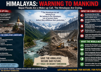
The Hindu Kush Himalaya region is warming at an alarming rate, and this temperature rise has serious implications. It leads to glacier retreat and thinning, which can destabilise mountain slopes. Additionally, thawing permafrost contributes to greater instability in rock faces and to the expansion and uncertainty surrounding glacial lakes. The combination of extreme weather, seismic activity, glacial instability, rapidly expanding infrastructure & settlements in narrow valleys is creating a new class of disasters.
These changes make high-altitude areas increasingly vulnerable to devastating events like ice-rock avalanches, landslides, and glacial lake outburst floods (GLOFs). Scientists have identified more than 200 high-risk glacial lakes across the Himalayan region alone, many of which could send flood waves downstream within minutes.
Why was this flood so destructive?
Nepal is a stunning but vulnerable country facing significant natural disaster risks. Its susceptibility stems from a mix of factors: ongoing tectonic activity, dramatic landscapes, heavy monsoon rains, and fragile geology, combined with urban development patterns.
The Himalayas formed from the collision of the Indian and Eurasian tectonic plates, putting much of the country at risk of major earthquakes. The World Bank estimates that over 80% of the population could be affected by these hazards, particularly earthquakes. The 2015 Gorkha earthquake is a prime example, affecting over 5.5 million people and causing over US$5 billion in damage, while triggering more than 21,000 landslides. With about 83% of its land mountainous, Nepal’s steep slopes and heavy rainfall often trigger landslides and erosion that disrupt infrastructure. Rapid urbanisation, especially in Kathmandu, worsens these risks, as unplanned growth and inadequate building codes increase vulnerability.
The recent disaster was exacerbated by several critical factors, all of which highlight the challenges we face in such vulnerable environments:
2. Mountain Geography: The narrow valleys of the Himalayas concentrate immense volumes of water and debris into confined channels, amplifying the destructive force when disasters strike. This geography can be unforgiving and dangerous.
4. Inadequate Warning Systems: Unfortunately, conventional flood warning systems are generally designed to monitor rainfall and river levels. They do not account for sudden glacier collapses, which can occur even under clear skies, creating floods before we have a chance to react.
Moreover, we must also consider the pressing concern of secondary glacial hazards. Authorities are currently monitoring a few more lakes formed after the collapse, raising further alarm about a cascade of dangerous events that could affect countless lives.
Many remote communities struggle with access, complicating post-landslide rescue efforts. The World Bank notes that Nepal’s risks stem from a combination of hazards, exposure, and vulnerability.
Disasters are Transborder
This situation highlights that natural hazards do not recognise political boundaries. The Tibetan side also experienced loss in its areas. India braces itself for the threat of floods. The impact of excessive rain and flooding could also be felt in deltaic Bangladesh.
The Himalayas serve as Asia’s water tower, affecting water availability for around 2 billion people downstream. Thus, Nepal isn’t just a country that experiences natural disasters; it sits at a crucial point where tectonic activity, steep terrain, and climate change converge, making it an essential case for disaster preparedness across the Himalayan region, including neighbouring India, Bhutan, Pakistan, and China.
The Himalayas should be viewed as one interconnected disaster-risk system rather than as separate national territories. There is a need for more convergence and reciprocity while planning projects in this fragile landscape.
Earthquake Vulnerability
When considering earthquake vulnerability, Nepal, northern India, Tibet (southwestern China), Bhutan, Pakistan, and Afghanistan form one of the world’s most significant seismic belts. This vulnerability arises from the ongoing collision between the Indian Plate and the Eurasian Plate, occurring at a rate of approximately 40 to 50 mm per year. The Indian Plate is being pushed beneath Eurasia, which accumulates enormous tectonic stress along faults, including the Main Himalayan Thrust.
India’s Ministry of Earth Sciences announced in December 2025 that, under its updated seismic zonation, the entire Himalayan arc is classified in the highest seismic risk category, Zone VI. The National Institute of Disaster Management estimates that about 59% of India’s landmass is susceptible to earthquakes of varying magnitudes, with 11% classified in the highest-risk Zone V and 18% in Zone IV.
All regions in China are equally susceptible to earthquakes. The areas of greatest concern include Tibet, Sichuan, Yunnan, Xinjiang, and western China. Tibet is especially significant in the context of Himalayan earthquakes, as seismic events in this region can directly impact Nepal, Bhutan, and northern India.
Yarlung Zangpo Project
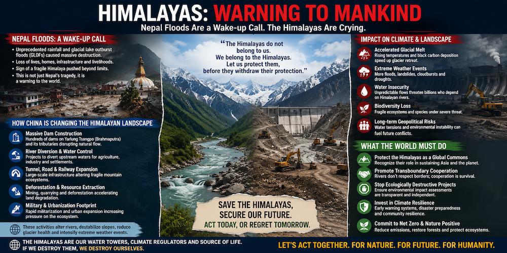 One major project that demands urgent global attention in the Himalayas is the Yarlung Tsangpo Hydropower Project, close to the highest militarily armed India-China border. The scale of this project, located in a geologically complex and seismically active region of the Himalayas, requires unprecedented independent scrutiny, transparency, and cross-border risk assessment.
Recent developments have only reinforced these concerns beyond what they were a year ago. Construction on the lower Yarlung Tsangpo in Tibet commenced in July 2025, at the river’s Great Bend. This project is set to generate around 60 GW, with an estimated annual output of nearly 300 billion kWh for $170-176 bn, positioning it to become the world’s largest hydropower initiative. The engineering challenges are immense, given the steep elevation drop of over 2000 meters over a 50 km stretch, deep Himalayan gorges, complex and fractured geology, active tectonics, unstable slopes, glaciers, and potential landslides.
A pivotal study by Chinese geologists published in 2026 identified the Paizhen Fault, which has been highly active since the Pleistocene era, as being directly beneath or significantly affecting the project area. The researchers have unequivocally warned that this fault could jeopardise the stability of dams, tunnels, roads, bridges, and the reservoir itself.
The Yarlung Tsangpo project is three times the size of the Three Gorges Dam. In 2005, Benjamin Fong Chao at NASA Goddard and Richard Gross at the Jet Propulsion Laboratory worked out the numbers. A full Three Gorges reservoir would lengthen every day on Earth by 0.06 microseconds, and shift the position of the pole by about 2 centimetres. The Three Gorges Dam achieved full capacity in 2010. No one has assessed the scale of the infrastructure required for the Yarlung Tsangpo project, which is three times bigger, or projected the adverse impact of this humongous project on Earth’s spin.
A Harvard study found that water held behind roughly 7,000 dams built since the 19th century has shifted the North Pole by about 1 metre and slightly lowered global sea level, because that water is sitting on land instead of in the ocean. The impact of the Yarlung Tsangpo project on the North Pole’s position remains to be assessed.
Worry for Lower Riparians
As the river flows into Arunachal Pradesh, it is known as the Siang, then transitions to the Brahmaputra in Assam and eventually reaches Bangladesh. As the principal lower-riparian country downstream, India faces valid and pressing concerns about sudden changes in water flow, sedimentation, flood management, lean-season flows, and strategic vulnerability due to the dam’s position near a politically sensitive international boundary.
It is unacceptable that India and Bangladesh, as downstream nations, currently lack comprehensive access to the project’s geological assessments, seismic risk models, dam-break scenarios, emergency response plans, reservoir operating protocols, environmental impact evaluations, sediment studies, and real-time hydrological data. In response to these alarming circumstances, India has made it clear that it expects China to resume sharing hydrological data related to the Yarlung Zangbo/Brahmaputra without delay.
To address these critical issues, a multinational panel—including Chinese, Indian, Nepalese, Bhutanese, and international experts—must conduct a thorough independent assessment of the Paizhen Fault, seismic hazards, slope stability, tunnel safety, landslide risks, and potential dam-break scenarios. Additionally, China must provide India and Bangladesh with continuous upstream river flow and earthquake data, rather than relying solely on periodic exchanges. Countries that share a river in such fragile geographies must have a right to independent information, prior consultation, real-time data, and credible guarantees against catastrophic downstream consequences.
What should we learn from it?
The most important lesson is that the Himalayas are entering an era in which traditional disaster models may no longer be sufficient. And there is a broader climate lesson: Nepal contributes very little to global greenhouse-gas emissions but is experiencing disproportionately severe consequences from a warming planet. The catastrophe therefore illustrates the principles of climate justice and climate risk. The response needs to include:
- Satellite and drone monitoring of unstable glaciers and slopes;
- Early-warning systems specifically designed for glacier collapses and GLOFs;
- Real-time river and seismic monitoring;
- Restrictions on construction in high-risk river corridors;
- Climate-resilient design of Himalayan roads and hydropower projects;
- Transboundary data sharing among China, Nepal, India and Bhutan;
- Systematic mapping of dangerous glaciers, lakes and unstable slopes.
- Local communities and governments must be empowered and equipped to act as first responders.
- A regional fund should support mitigation and rehabilitation for affected communities/countries.
Final Thoughts
We can not always blame natural phenomena for disasters and calamities. We build in floodplains and on steep, unstable slopes, and we destroy forests, unmindful of the vulnerabilities these actions create. We have to stop playing God, trying to overpower nature. We need to understand nature better and live by her rules for harmonious coexistence.
Whenever major infrastructure projects are planned in potentially seismically unstable areas, the design, disaster mitigation, and modelling should be shared with all concerned parties.